Crime & Safety
Cal Fire Map Shows Earth Scorched by Mount Diablo Fire
See the official maps of where the fire charred more than 3,500 acres on Mount Diablo.


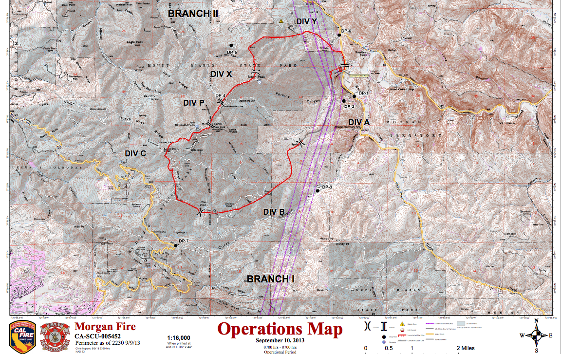
Cal Fire and East Contra Costa County Fire Protection District released a map of the area burned on Mount Diablo Tuesday morning, which details the extent to which this fire scorched the Earth.
On Tuesday at about 11:29 a.m., the fire, which is also known as the Morgan Fire, was about 45 percent contained. 3,243 acres burned.
For the latest information about the fire on Mount Diablo, visit this post here on Patch.
Note: We added a second map that more clearly elucidates the burned area at 1:29 p.m. It's the one with more green color.
Get more local news delivered straight to your inbox. Sign up for free Patch newsletters and alerts.
We’ve removed the ability to reply as we work to make improvements. Learn more here